Central · Thailand
Saraburi · สระบุรี
Phra Phutthabat temple (Buddha's footprint), sunflower fields in November.
- Region
- Central
- Population
- 643,000
- Area
- 3,576 km²
- Stories filed
- 1
About Saraburi
History
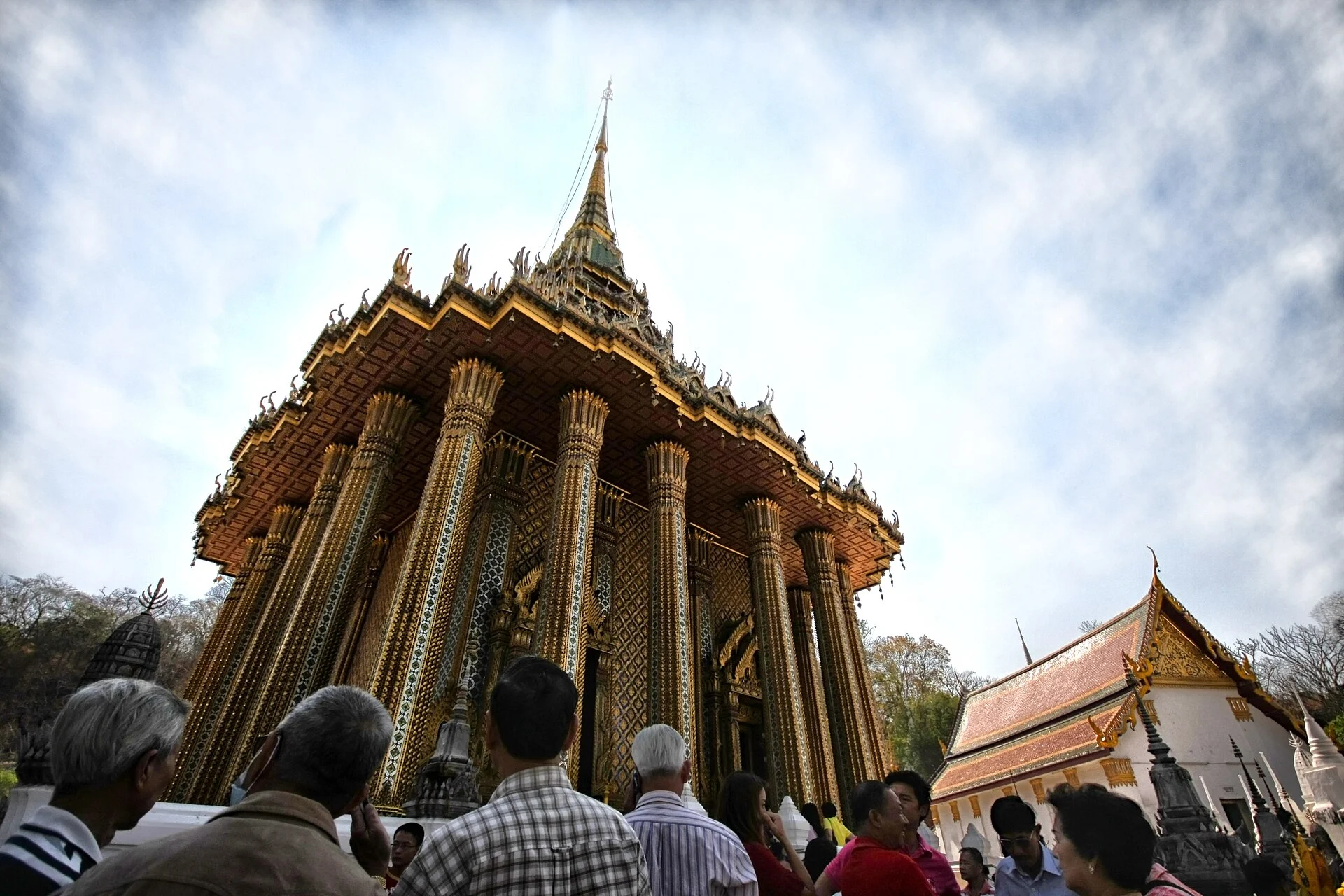
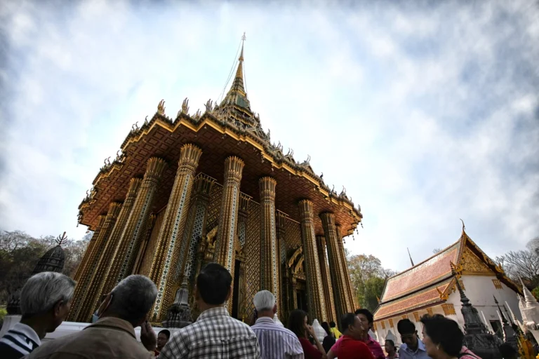
Saraburi's defining landmark is Wat Phra Phutthabat — the "Buddha's Footprint" shrine — said to have been discovered in the reign of King Songtham in the early seventeenth century, when a deer's miraculous recovery from its wounds revealed a sacred impression in the rock. Ayutthayan and Chakri kings made the site a royal pilgrimage, and its annual festivals in February and March remain among the kingdom's most attended. The province also served as an Ayutthayan military outpost from 1548, and the Pasak Chonlasit Dam (completed 1994) transformed the Pa Sak valley into a reservoir and irrigation network.
Landscape & geography
Saraburi bridges the flat central plain to the west and the limestone ridges of the Khao Yai escarpment to the east. Cement quarries — the province produces the bulk of Thailand's cement — give way to teak-forested hills on the eastern fringe. Sunflower fields blanket the higher plains from November through February, turning hillsides bright yellow; the Pasak Chonlasit reservoir provides year-round recreation and boating.
Why visit
The Buddha footprint shrine at Wat Phra Phutthabat draws pilgrims by the busload during its winter festivals — a vivid immersion in Thai devotional culture. The sunflower plains at Khao Chin Lae are the photogenic seasonal highlight — arrive in January for peak bloom and drive the back roads. Namtok Chet Sao Noi waterfall is an easy day-hike inside its own national park annex. Most visitors treat Saraburi as a day trip from Bangkok (108 km) or a natural stop en route to Khao Yai.
Stories from Saraburi
Articles, reviews, and itineraries tagged to this province.