Central · Thailand
Phetchabun · เพชรบูรณ์
Khao Kho mountain plateau, Phu Thap Boek flower fields, sweet tamarind.
- Region
- Central
- Population
- 986,000
- Area
- 12,668 km²
- Stories filed
- 1
About Phetchabun
History
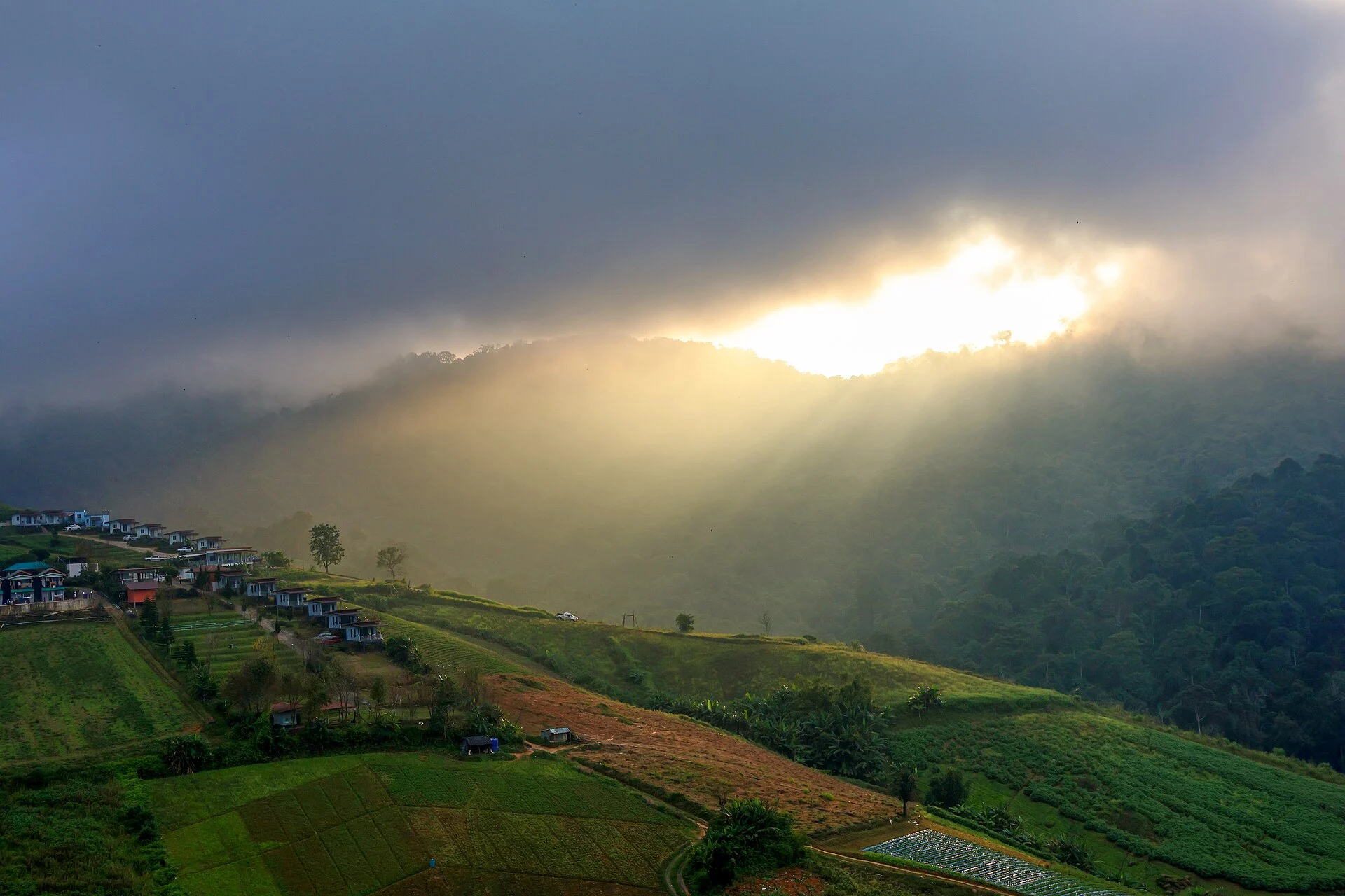
Phetchabun — \"City of Diamond Fields\" — sat on the old land route between Sukhothai and the Khmer heartland to the south-east, making it strategically contested through multiple kingdoms. Its highland reaches were the last Communist Party of Thailand stronghold during the insurgency of the 1960s–1970s, centred on the Khao Kho plateau base where several thousand fighters held out until the government's amnesty programme of 1981. Former fighters-turned-farmers planted tamarind and pummelo orchards in the same valleys; the province now produces the sweetest tamarind in Thailand.
Landscape & geography
The province straddles the fertile Pa Sak valley between two north-south mountain ranges — the Phetchabun range to the east and the Dong Phaya Yen escarpment to the west. Khao Kho, Nam Nao, and Thung Salaeng Luang national parks occupy the peaks and plateaus, with cool pine forests, open grassland, and waterfalls rare in tropical Thailand. The Pa Sak river drains south through the valley; the Pasak Chonlasit reservoir provides a freshwater focal point between the park zones.
Why visit
Khao Kho is the primary draw in cool season — the plateau's hill-country resorts, sea-of-mist dawns, and former insurgent base turned military museum reward two nights. The Wat Phra That Pha Son Kaeo crystal-mosaic temple on the hillside is one of the region's most photographed religious buildings. Nam Nao's forest hiking and Thung Salaeng Luang's open grassland with wild gaur sightings fill out a third day. Leave time to buy tamarind candy and pummelo at roadside stalls on the Pa Sak valley highway — the produce here has no equal in Thailand.
Stories from Phetchabun
Articles, reviews, and itineraries tagged to this province.