Northeastern · Thailand
Si Sa Ket · ศรีสะเกษ
Preah Vihear border views, durian-onion-shallot trio, Khmer temples.
- Region
- Northeastern
- Population
- 1,458,000
- Area
- 8,840 km²
- Stories filed
- 1
About Si Sa Ket
History
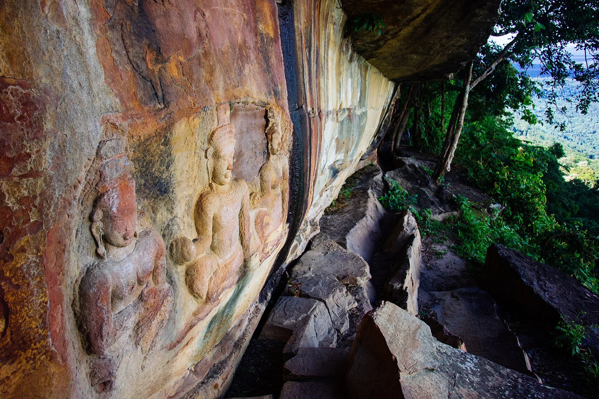
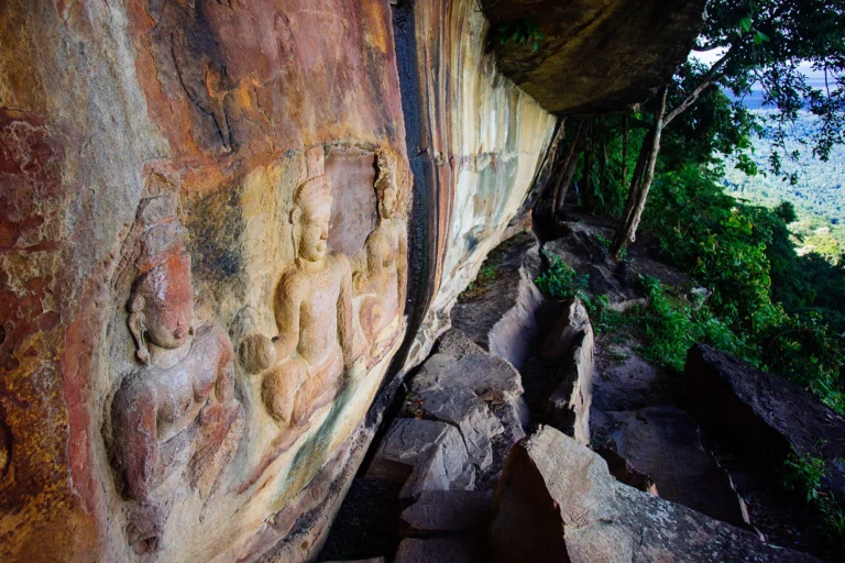
Si Sa Ket sits at the intersection of Thai, Lao, and Khmer worlds on the southern margin of the Khorat Plateau, its border country historically contested and its population still a mosaic of Lao, Kuy, and Khmer communities. The province is known as a garlic-growing region — its volcanic soil produces a pungent, small-cloved variety that is a staple of Isan cooking — but its historical weight comes from the Dangrek mountain escarpment, whose cliff-face forms the natural border with Cambodia and whose temples were administrative centres of the Khmer empire's northern reaches. The disputed Preah Vihear sanctuary, built in the eleventh century on the Cambodian side of the cliff, has been at the centre of a long-running territorial dispute that flared into armed clashes in 2008 and 2011.
Landscape & geography
The Dongrek escarpment is Si Sa Ket's defining geographic feature: a sandstone cliff-face that drops some 500 metres from the Thai plateau to the Cambodian plain below, stretching east for over 200 kilometres and forming the entire southern border of the province. The view from Pha Mo I-Daeng — a sandstone promontory at the lip of the cliff — is one of the most dramatic in mainland Southeast Asia, encompassing the Cambodian plain all the way to the horizon. The plateau above the escarpment is rice and cassava country, drained by the Mun River to the north, and dotted with scattered laterite quarry sites and Khmer baray between the provincial capital and the border.
Why visit
Prasat Wat Sa Kamphaeng Yai — a twelfth-century Khmer sanctuary with five intact prangs in a walled enclosure — is among the best-preserved temple complexes in Isan and sees almost no foreign visitors. Pha Mo I-Daeng at sunset, with the escarpment dropping away and the Cambodian plain glowing below, is worth a detour in its own right. The Wat Lan Kuat — a village temple decorated with over a million recycled glass bottles — is one of the province's odder and more memorable attractions. Si Sa Ket pairs naturally with Surin for a two-province Khmer-border loop that rewards slow travel.
Stories from Si Sa Ket
Articles, reviews, and itineraries tagged to this province.