Southern · Thailand
Satun · สตูล
Koh Lipe, Koh Tarutao national park, UNESCO Satun Geopark.
- Region
- Southern
- Population
- 325,000
- Area
- 2,479 km²
- Stories filed
- 1
About Satun
History
Satun was a Malay sultanate absorbed into Thailand in 1909 under the Anglo-Siamese Treaty that drew the modern southern border. Unlike the three Pattani-area provinces to its east, Satun's Muslim-Malay majority accepted the transition relatively peacefully, and the province has remained stable and welcoming to visitors throughout the period of insurgency affecting its neighbours. Its population is majority Malay-Muslim, its architecture is mosque-dotted rather than temple-rich, and the food is as much Malay as Thai — gulai, roti, and fresh coconut-milk curry define the local kitchen.
Landscape & geography
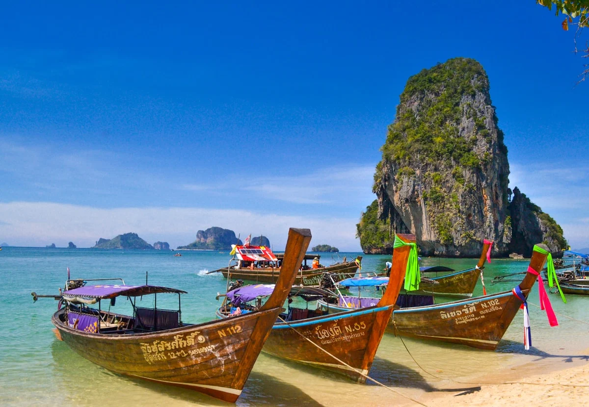
A long Andaman coastline with a largely intact coral reef system and a huge offshore archipelago — the Tarutao National Marine Park — encompassing fifty-one islands including Tarutao, Lipe, and Adang-Rawi groups. The Tarutao mainland coast is part of a UNESCO Global Geopark recognised for its Cambrian limestone geology. The interior rises into rubber and oil-palm plantations before meeting the Malaysian border in the Sankalakhiri range. The Pak Bara pier is the gateway to all park islands.
Why visit
Koh Lipe is the headline — a small, sociable island with coral-fringed beaches and enough accommodation to suit budgets from backpacker bungalow to boutique resort. Koh Adang and Koh Rawi nearby offer day-trip snorkelling in cleaner reef than Koh Lipe itself. Tarutao island has ranger-run bungalows, a crocodile cave, and a fascinating history as a World War II political prison camp. The Ko Tarutao UNESCO Global Geopark's cave systems and sea-stack formations around La-ngu are among Thailand's most undervisited geological landscapes.
Stories from Satun
Articles, reviews, and itineraries tagged to this province.