Southern · Thailand
Chumphon · ชุมพร
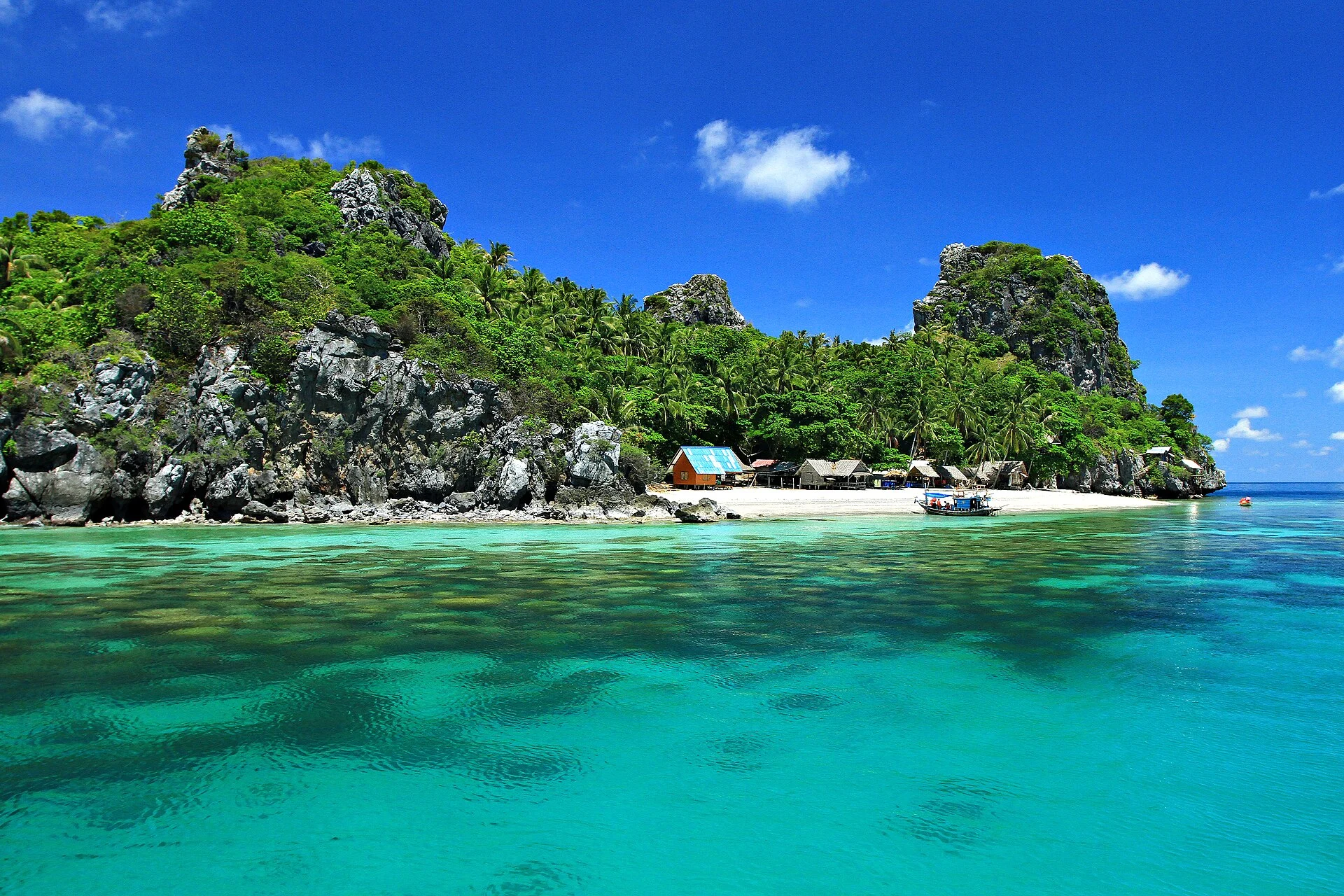
Thung Wua Laen beach, ferry port to Koh Tao, gateway to the south.
- Region
- Southern
- Population
- 515,000
- Area
- 6,009 km²
- Stories filed
- 1
About Chumphon
History
Chumphon is the \"gate of the south\" — the narrowest stretch of the Isthmus of Kra and the traditional overland route between the central plain and the Malay peninsula, controlling trade since at least the Ayutthayan period. Japanese forces landed at several points along the Chumphon coast in December 1941 in their advance toward Malaysia and Singapore; the coastal gun battery at Hat Sai Ri commemorates the brief Thai resistance. The province produced the naval career of Prince Abhakara Kiartivongse, whose promotion of the local seafood culture is still celebrated at an annual festival.
Landscape & geography
A long Gulf of Thailand coast of alternating white-sand beach, rocky headland, and mangrove estuary, with the Chumphon archipelago's offshore islands — Koh Ngam Yai, Koh Ngam Noi, and Koh Tao visible on the horizon — popular for diving and snorkelling. The Tenasserim range rises steeply inland, its forested ridges forming a weather barrier giving Chumphon sharply different rainfall on its west and east sides. The province produces coconuts, cashews, and an unusual variety of rambutan called rongrian.
Why visit
Chumphon is primarily a ferry-transit hub for Koh Tao and Koh Phangan; the night boat from the pier to Koh Tao remains one of Thailand's iconic budget-travel transitions. Travellers who stay find empty beaches at Thung Wua Laen — a seven-kilometre crescent with clear water and no development at its northern end — and quiet reef diving off Koh Ngam Noi. The provincial night market near the town clock tower is one of the south's best for local seafood. The rongrian rambutan festival in September is worth timing a visit around.
Stories from Chumphon
Articles, reviews, and itineraries tagged to this province.