Northeastern · Thailand
Amnat Charoen · อำนาจเจริญ
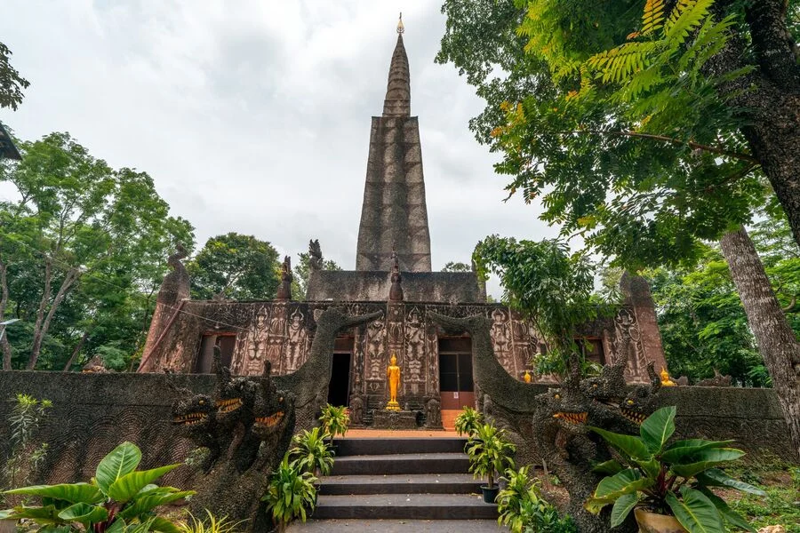
Phu Sa Dok Bua summit, quiet Mekong-adjacent countryside.
- Region
- Northeastern
- Population
- 377,000
- Area
- 3,161 km²
- Stories filed
- 1
About Amnat Charoen
History
Amnat Charoen was carved from Ubon Ratchathani in 1993, making it one of Thailand's newest and smallest provinces. The name — roughly "City of Victorious Power" — reflects the martial legacy of a region that was a corridor for armies moving between the Khorat Plateau and the Mekong throughout the Ayutthaya and Chakri periods. The Mun River marks the northern boundary and has long been a source of fish, trade, and occasional flood; the crossing points at Chanuman and Phana are still where cross-border traffic flows to and from Laos.
Landscape & geography
The province spans low river plains and scattered forest patches between the Mun River and the Mekong bend, with Kaeng Yai National Park's rapids and waterfall gorges providing the only significant vertical relief. The scenery is green and agricultural — rice in the wet season, bare earth and cassava in the dry — with the exception of the Mekong frontage at Chanuman, where the river widens and Lao hills on the opposite bank give depth to an otherwise flat horizon.
Why visit
Amnat Charoen is among Isan's most genuinely off-the-trail provinces — almost no foreign tourists, minimal English infrastructure, and a pace of life that is entirely village-oriented. Wat Phra Lao Thep Nimit anchors the capital with its revered standing Buddha. Kaeng Yai's rapids and forest trails are an easy day-trip, and the Mekong waterfront at Chanuman is pleasant at sunset. The province makes a quiet overnight on a slow loop between Ubon Ratchathani and Mukdahan.
Stories from Amnat Charoen
Articles, reviews, and itineraries tagged to this province.